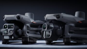
Photogrammetry Drones
Discover SITECH Solutions’ photogrammetry drone offering, featuring the DJI Matrice 4 Series. Capture precise, high-resolution data for aerial surveying, mapping, and volumetric analysis. Ideal for construction, mining, and geospatial professionals …
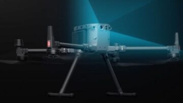
Lidar Drones
SITECH Solutions offers LiDAR drone systems for capturing detailed ground surface data in complex terrain. Paired with high-precision sensors, our drone solutions are ideal for construction, mining, and environmental projects requiring accurate …
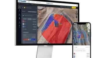
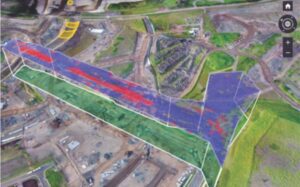
Trimble Stratus
Trimble Stratus is a powerful drone data workflow solution powered by Propeller, designed to help civil contractors and site managers efficiently map, measure, and manage worksites. With intuitive tools and seamless integration, Trimble Stratus …
Software Solutions
Discover Trimble Software Solutions designed for civil construction projects. Increase efficiency, reduce downtime, and stay connected with tools like Trimble WorksOS, WorksManager, and Stratus.
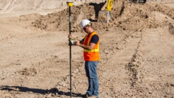
Site Positioning Systems
Tough, accurate, and connected Trimble site positioning systems that deliver precision - reliable and accurate results from the field to your office, no matter the distance.