High Precision Aerial Mapping with the DJI Matrice 4 Series
Take your surveying capabilities to new heights with SITECH Solutions' photogrammetry drone solutions.
We supply the latest DJI Matrice 4 Series – intelligent, multi-sensor drones built to deliver precision, reliability, and performance in construction, mining, and geospatial industries.

Compact and Powerful Aerial Mapping Tools
The DJI Matrice 4 Series includes the Matrice 4T and Matrice 4E, designed for advanced aerial inspection, mapping, and surveying applications. With integrated wide-angle, telephoto, and laser range-finding capabilities, these drones provide highly accurate spatial data in even the most challenging environments.
DJI Matrice 400
The DJI Matrice 400 is a flagship enterprise drone built for complex industrial and commercial missions. It offers up to 59 minutes of flight time, supports payloads up to 6 kg, and features advanced obstacle detection with 360° LiDAR and omnidirectional sensors. Its O4 Enterprise transmission delivers triple-channel 1080p live feeds at ranges up to 40 km, making it ideal for surveying, inspections, and emergency response.
Matrice 4
The DJI Matrice 4 is a compact, AI-powered enterprise drone tailored for high-precision mapping, surveying, and inspection tasks. It features a 20MP 4/3-inch CMOS wide-angle camera with a mechanical shutter, complemented by 48MP medium telephoto and telephoto lenses, and an integrated laser rangefinder for precise measurements up to 1,800 metres. With a flight time of up to 49 minutes and advanced obstacle avoidance systems, the Matrice 4E is ideal for geospatial applications in construction, mining, and infrastructure projects .
DJI Mavic 3 Enterprise (M3E)
The DJI Mavic 3 Enterprise (M3E) is a compact, foldable drone designed for professional mapping and inspection tasks. It features a 20MP 4/3 CMOS wide-angle camera with a mechanical shutter, a 12MP telephoto lens offering up to 56× hybrid zoom, and optional RTK support for centimetre-level positioning accuracy. With up to 45 minutes of flight time and omnidirectional obstacle sensing, the M3E is ideal for efficient, high-precision missions in surveying, infrastructure inspection, and public safety operations.
Key Features of DJI Matrice Series 4 Photogrammetry Drones
-
Multi-Sensor Payloads
Capture clear, accurate images with wide-angle, medium telephoto, and high-resolution zoom cameras (up to 48MP). The Matrice 4T also includes a thermal camera and NIR auxiliary light for night operations.
-
High Precision Measurement
Integrated laser range finder with ±0.2m accuracy allows for pinpoint distance, line, and area calculations—ideal for inspections and ground control marking.
-
Fast, Accurate Aerial Mapping
With 0.5-second interval shooting, 5-directional oblique capture, and Smart 3D Capture, the Matrice 4E maximises efficiency without sacrificing quality.
-
Night and Low-Light Operation
Enhanced Full-Colour Night Vision, Smart Low-Light Photo, and NIR illumination hardware make the Matrice 4T ideal for dusk and nighttime flights.
-
Omnidirectional Sensing for Safer Flights
Six low-light fisheye sensors provide enhanced visual positioning and obstacle avoidance, even in urban or low-light conditions.
-
Real-Time Data Sharing
Equipped with DJI Pilot 2 and optional 4G image transmission, pilots can stream, share, and collaborate on data instantly.
Photogrammetry Drone Applications
Surveying and Mapping
Collect accurate point clouds, DSMs, and 3D models across large sites in less time.
Earthworks Monitoring
Perform repeatable flight missions to track progress, measure volumes, and support billing or tender processes.
Construction and Mining
Reduce risk and field time by capturing data from above. Use data for planning, monitoring, and verifying work on-site.
Environmental and Forestry
Survey large or inaccessible areas quickly, with sensors capable of identifying tree health, canopy cover, and terrain.


Why Choose SITECH Solutions’ Photogrammetry Drones?
SITECH Solutions is your trusted Trimble dealer and DJI Enterprise partner, providing comprehensive aerial mapping solutions backed by expert local support. From system selection to integration with Trimble Stratus or third-party software, we’ll ensure your drone data delivers maximum value.
Request a Demo or Quote
Speak with our team today about the DJI Matrice 4 Series and how drone-based photogrammetry can enhance your operations.
Related Applications
From aerial data processing to LiDAR-enabled capture, these solutions work alongside photogrammetry drones to improve efficiency and accuracy on every site.
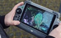
Propeller Drone Platform
Propeller is a cloud-based drone platform designed to help civil contractors and site managers map, measure and manage worksites efficiently. By bringing site maps, survey data and real-time insights together in one platform, Propeller improves …
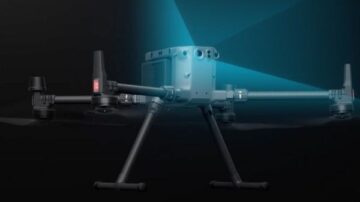
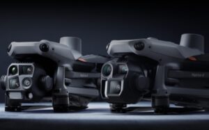
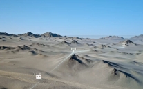
Lidar Drones
SITECH Solutions offers LiDAR drone systems for capturing detailed ground surface data in complex terrain. Paired with high-precision sensors, our drone solutions are ideal for construction, mining, and environmental projects requiring accurate …
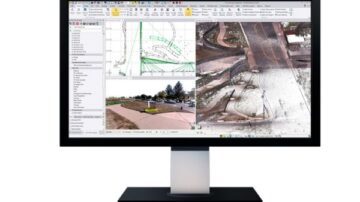
Trimble Business Center (TBC)
Manage data, create 3D models, and streamline project workflows with Trimble Business Center. TBC is the software solution that enables accurate takeoffs, collaborative data management, and informed decision-making for construction and surveying …